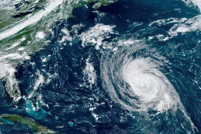
ST. JOHN'S, N.L. — As hurricane Larry churns its way toward eastern Newfoundland, residents of the Avalon Peninsula are being warned to brace for hurricane-force winds gusting at 140 kilometres per hour some time tonight.
Hurricane warnings are in effect for the entire peninsula, which includes St. John's.
The Canadian Hurricane Centre in Halifax said the powerful winds are expected to topple trees, pull down power lines, and damage property. Residents are being urged to secure loose objects and prepare for power outages and local flooding from heavy rainfall.
The centre said the storm is expected to make landfall somewhere along the coast of Placentia Bay, the large body of water that separates the southern Avalon from the rest of the island.
The provincial government issued a statement saying residents should prepare a basic emergency kit to sustain them for at least 72 hours. The kit should have food, water, batteries, a portable radio, and prescription medications.
Meanwhile, tropical storm warnings have been issued for the rest of the eastern half of the province, where gusts up to 110 km/h are expected over exposed areas.
As well, storm surge warnings are in effect for the southern Avalon and the Burin and Connaigre peninsulas, where maximum wave heights could reach 14 metres close to shore.
Larry is expected to enter Canadian offshore territory as a Category 1 hurricane with sustained winds up to 140 km/h, but those winds are expected to diminish as the storm moves over colder water near Newfoundland's southern coastline.
The latest forecast models indicate the hurricane will transition to a post-tropical storm, but it could retain much of its strength as it dumps up to 50 millimetres of rain on eastern Newfoundland.
"The major impacts will be for south-facing coastlines of Newfoundland, especially near and east of the Connaigre and Avalon peninsulas," the centre said in a statement.
Coastal flooding is possible in the town of Placentia, which is on the eastern side of the sprawling bay, the centre warned.
Later in the day, the province's public safety department issued a statement warning of pounding surf along southern coastlines.
"There is potential for damage to coastal infrastructure from storm surge and residents should avoid coastal areas, if at all possible," the statement said. "Conditions may be hazardous and emergency officials advise the public to use extreme caution."
In the event of a blackout, the province is asking people to use flashlights instead of candles and to refrain from using a gas range, stove or oven to heat a home.
"You should use extra layers of clothes and blankets to stay warm," the statement said, adding that electric generators should not be used inside of any structure, including garages and sheds.
Larry is expected to have little impact on the Maritimes, where heavy rain was reported overnight in some areas. Large ocean swells are expected to spread along the Atlantic coast of Nova Scotia as the storm's track will remain far offshore.
"These waves will be particularly large later today, presenting a hazard to those close to the shore," the hurricane centre said. "As the storm approaches eastern Newfoundland this evening, dangerous breaking waves are expected to develop along the southern Avalon Peninsula."
Offshore, the Grand Banks will experience the greatest wave growth, with some models suggesting 15-metre waves.
This report by The Canadian Press was first published Sept. 10, 2021.
The Canadian Press


