Explosively intensifying Hurricane Milton is the latest freaky system to come out of what veteran hurricane scientists call the weirdest storm season of their lives.
Before this Atlantic hurricane season started, forecasters said everything lined up to be a monster busy year, and it began that way when Beryl was the earliest storm to reach Category 5 on record. Then, nothing. From Aug. 20 — the traditional start of peak hurricane season — to Sept. 23 it was record quiet, said Colorado State University hurricane researcher Phil Klotzbach.
Then five hurricanes popped up between Sept. 26 and Oct. 6, more than double the old record of two. On Sunday and Monday, there were three hurricanes in October at the same time — something that never happened before — Klotzbach said. In just 46.5 hours, Hurricane Milton went from just forming as a tropical storm with 40 mph winds to a top-of-the-charts Category 5 hurricane with 160 mph winds and then it got even stronger.
“I was looking as far back as the Atlantic records go and there’s not really any good analogs for this season, just how neurotic it’s been,” Klotzbach said. “You know, obviously the season ain’t over yet. We’ll see what pops up after Milton.”
MIT meteorology professor Kerry Emanuel has been studying hurricane seasons since the 1980s and he’s never seen anything quite like this year. That includes a year when there were so many storms forecasters ran out of names and had to use the Greek alphabet.
Before hurricane season started June 1, forecasters such as Klotzbach and the federal government looked at the record hot oceans and an embryonic La Nina cooling of parts of the Pacific that brings winds and other conditions that foster hurricane formations. They made bold predictions of an extremely busy season. It was nearly unanimous.
When Beryl became a Category 5 hurricane in early July, they were looking prescient.
Then came mid August. Aug. 20 is such a milestone marking the beginning of peak hurricane season — which runs to mid October — that hurricane season forecasting pioneer Bill Gray used to ring a bell as sort of a starter's pistol. This year when a student rang the bell, the storm activity seemed to ground nearly to a halt. When computing a combination of storm strength and duration, the next month was the lowest on record, Klotzbach said.
That was strange because the Gulf of Mexico, Caribbean and parts of the Atlantic were at record or near record high temperatures, acting as giant gas stations for hurricanes. But the air was also warming to an unusual degree and more than sea surface temperature. It's the difference between water and air temperatures that matter and that was just too low, Emanuel said.
Add to that a natural weather phenomenon pushed air from high up to sink down low over the Atlantic, which made it tougher for hurricanes to form, said University of Albany atmospheric scientist Kristen Corbosiero.
And dust in the African Sahara was expanding and interfering with the development of systems that could eventually become hurricanes, said Bernadette Woods Placky, chief meteorologist for Climate Matters that looks at weather events for fingerprints of human-caused climate change.
“I found it encouraging that we weren’t seeing as many hurricanes," Woods Placky said. “Even if it did bust the forecast a little bit, of course, we don’t want to see these devastating storms.”
But it didn't last.
The upper air got cooler, the sinking air moved away, and in the Gulf of Mexico the Central American Gyre — a whirling overarching weather system — took over. That started the spin that kept kicking out hurricanes, Corbosiero said. Hurricane Helene formed, followed by Isaac, Kirk, Leslie and now a monstrous Milton.
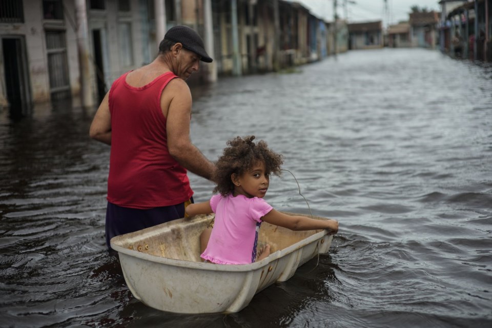
Helene was one of the largest storms in size in recent decades, which allowed it to gather more moisture from the Gulf of Mexico and plowed inland till it hit the mountains, which caused even more rain to fall. The warmer Gulf made it rain more and human-caused climate change made the hotter waters more than 300 times more likely, Woods Placky said, using her organization's calculations. A flash study by researchers at the Lawrence Berkeley National Lab found that climate change boosted Helene's rainfall by 50% in some parts of Georgia and the Carolinas.
Helene rapidly intensified in those warm waters, but when Milton came along it gained strength at a much higher clip, quadrupling in wind speed in less than two days. Milton became the seventh storm in the last 20 years to gain at least 75 mph in wind speed in just 24 hours and none did so between 1950 and 2000, Klotzbach said.
Corbosiero, Klotzbach and Emanuel said random chance, other weather conditions, perhaps the 2022 undersea volcano eruption that shot lots of water vapor into the atmosphere all could have also played a role in the weird hurricane season.
Woods Placky said the future looks grim.
“The warmer we get, the worse these are going to become,” she said. “There's a direct connection between the damage we're seeing in communities far and wide and the amount of greenhouse gases we put into the atmosphere.”
___
Read more of AP’s climate coverage at http://www.apnews.com/climate-and-environment
___
Follow Seth Borenstein on X at @borenbears
______
The Associated Press’ climate and environmental coverage receives financial support from multiple private foundations. AP is solely responsible for all content. Find AP’s standards for working with philanthropies, a list of supporters and funded coverage areas at AP.org.
Seth Borenstein, The Associated Press


