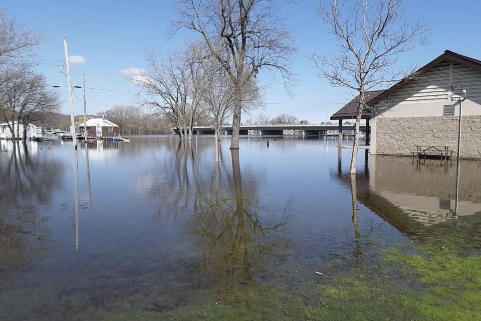
DES MOINES, Iowa (AP) — Some residents along the swelling Upper Mississippi River evacuated their homes this week while others scrambled Wednesday to stack sandbags in preparation for what forecasters say could be near-record flooding caused by the rapid melting of a huge snowpack in northern Minnesota.
A small number of people had to leave their homes in Wisconsin as the river kept rising. In the small riverfront community of Buffalo, Iowa, residents — wary of the devastating floods of 2019 — were stockpiling sandbags as they braced for flooding this weekend and early next week.
In the city of Campbell, located on an island in the Mississippi and Black rivers near La Crosse, Wisconsin, Fire Chief Nate Melby said some residents had to use canoes to reach their homes. Melby estimated a half-dozen people have decided to evacuate after the rising waters forced emergency workers to cut power and gas to their homes. Emergency officials have not issued mandatory evacuation orders, though, he said.
“We’re putting up a good fight,” Melby said. “We’re hanging in there.”
Amy Werner, who lives on the northern tip of French Island, has been using six pumps to remove river water from a crawl space. Werner said it’s been a 24-hour-a-day battle, with friends and her parents taking turns monitoring the pumps during the nights.
She estimated the pumps are removing 25,000 to 30,000 gallons of water per hour.
“It’s pretty stressful,” Werner said. “It’s bubbling up from the ground. I’ve been living my life by every hour for about 10 days now, and it’s not over yet. (But) so far we’re holding our own.”
The Mississippi was expected to be especially high along parts of Wisconsin and to crest Wednesday or early Thursday in La Crosse, a city of about 50,000 people. In Iowa, forecasts predict the river will reach the third-highest level ever recorded when it crests Saturday about 160 miles to the south in Davenport.
About 60 miles (100 kilometers) downriver from La Crosse at Prairie du Chien, the Mississippi was a little more than 6 feet (1.8 meters) above flood stage Wednesday morning. The water was expected to continue rising each day until Saturday, when it’s expected to crest at just under 25 feet (7 meters). The record high was 25 feet, 3 inches (7.7 meters) in April 1965.
Video footage shot by WKBT-TV on Tuesday showed water at least a foot deep covering city streets and yards.
Crawford County Emergency Management Specialist Marc Myhre said that some families have evacuated and are staying with other family members, but as of Tuesday officials hadn’t issued mandatory evacuation orders. A message left at the county emergency management offices on Wednesday morning wasn’t immediately returned.
In Iowa, improved floodwalls and other temporary measures should prevent significant problems, but crews were constantly monitoring the river, officials in the cities of Dubuque, Davenport and Burlington said. Forecasts call for only a chance of light showers later in the week.
Crews in Dubuque, a city of about 60,000, had closed 13 of the city’s 17 floodgates and started up four permanent pumping stations and three temporary pumps to suck water over the floodwall and back into the river by Wednesday.
“Now we’ve got to get through the next three or four days of rain, but I think we will be in good shape,” Dubuque Public Works Director John Klostermann told the Des Moines Register.
Downstream, officials in Davenport and Bettendorf have closed roads near the river, and Davenport workers set up temporary sand-filled barriers to protect downtown. In 2019, barriers failed and allowed water to rush into parts of downtown, but officials said this time the barrier will be much deeper and higher.
__
Richmond reported from Madison, Wisconsin.
Scott Mcfetridge And Todd Richmond, The Associated Press


