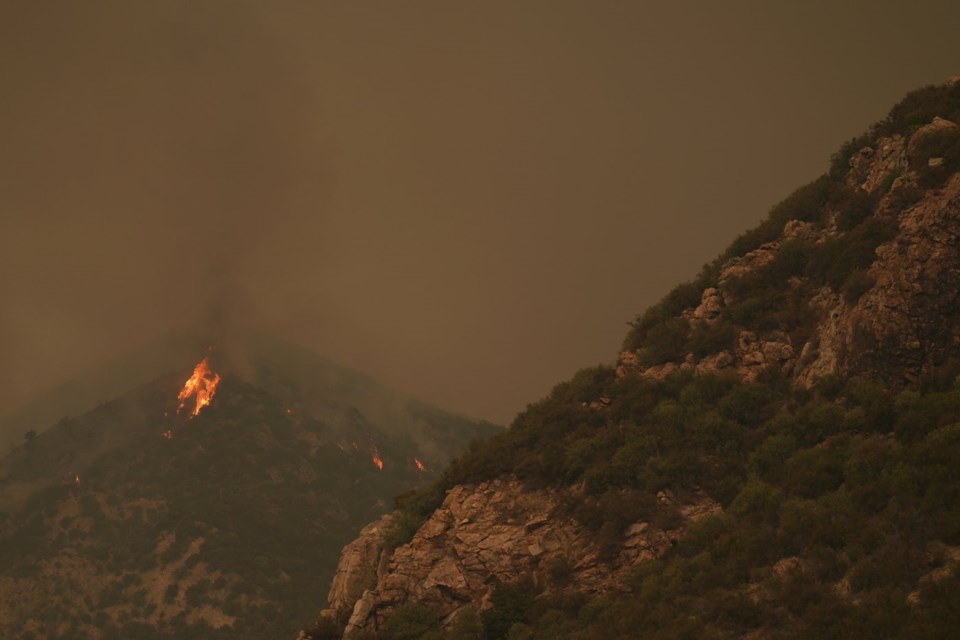
MOUNTAIN HOME VILLAGE, Calif. (AP) — As a raging wildfire continues to spread east of Los Angeles, driven by days of triple-digit temperatures, a teacher in an evacuation zone is planning to keep instructing online at his home in a Southern California mountain town.
Stephen Richardson, whose 1930s wooden cabin in the unincorporated community of Mountain Home Village is in the path of the Line Fire, said Monday he installed more fire-resistant siding to the structure and trimmed some branches away from his house.
“That’s about all I can do, aside from standing on the top of the roof with my garden hose, but that’s not in the plans,” said Richardson, a math and physics instructor at Platt College who planned to meet with his students online before deciding whether to leave the community where he was born and raised.
“If we’re seeing flames and the air gets bad, we’re probably going to head down,” he said.
Southern California mountain community residents like Richardson are mulling whether to stay and protect their homes or leave. Cal Fire spokesperson Rick Carhart said the fire led at least 6,000 people to evacuate.
“We're dealing with triple-digit temperatures and hard-to-reach steep areas where there has not been fire in decades, or in recorded history, so all that vegetation has led to significant fuel loads,” Carhart said.
Mara Rodriguez, a spokesperson with the San Bernardino County Sheriff's Department, which issues evacuation orders, said nearly 5,000 homes fell under the existing orders and nearly 17,000 more were under evacuation warnings.
The blaze threatened thousands of home and commercial structures as it burned along the edge of the San Bernardino National Forest, about 65 miles (105 kilometers) east of Los Angeles. As of Monday evening, the blaze had charred about 37 square miles (96 square kilometers) of grass and brush and blanketed the area with a thick cloud of dark smoke. It was 5% contained.
Meanwhile, firefighters were using bulldozers, helicopters and airplanes Monday to control another rapidly spreading blaze that broke out near a remote-controlled airplane airport in Orange County southeast of Los Angeles. The fire spread to about 3 square miles (7.8 square kilometers) in only a few hours.
In Northern California, a fire measuring less than a square mile (2.6 square kilometers) started Sunday and burned at least 30 homes and commercial buildings and destroyed 40 to 50 vehicles in Clearlake City, 110 miles (117 kilometers) north of San Francisco, officials said. Roughly 4,000 people were forced to evacuate by the Boyles Fire, which was about 40% contained Monday afternoon.
The fires are among the most dangerous of the many burning in various parts of California.
About 20 miles (32.2 kilometers) outside Reno, Nevada, the uncontained Davis Fire grew to about 10 square miles (26 square kilometers) after igniting Sunday afternoon. It originated in the Davis Creek Regional Park in the Washoe Valley and was burning in heavy timber and brush, firefighters said.
An emergency declaration issued for Washoe County by Gov. Joe Lombardo on Sunday noted that about 20,000 people were evacuated from neighborhoods, businesses, parks and campgrounds. Parts of south Reno remained under the evacuation notice on Monday, firefighters said, and some homes, businesses and traffic signals in the area were without power.
The Southern California blaze burned so hot Saturday that it created its own thunderstorm-like weather systems of pyroculumus clouds, which can create more challenging conditions such as gusty winds and lightning strikes, according to the National Weather Service.
The Reno fire is roughly 480 miles (770 kilometers) to the northeast of the blaze in the San Bernardino National Forest, where firefighters worked in steep terrain in temperatures above 100 degrees (38 Celsius), limiting their ability to control the blaze, officials said. State firefighters said three firefighters had been injured.
Evacuations were ordered Saturday evening for Running Springs, Arrowbear Lake, areas east of Highway 330 and other regions.
Running Springs resident Steven Michael King said he had planned to stay to fight the fire and help his neighbors until Sunday morning, when the fire escalated. He had prepped his house to prevent fire damage but decided to leave out of fear smoke could keep him from finding a way out later.
"It came down to, which is worse, being trapped or being in a shelter?” King said outside an evacuation center Sunday. “When conditions changed, I had to make a quick decision, just a couple of packs and it all fits in a shopping cart.”
The affected area is near small mountain towns in the San Bernardino National Forest where Southern California residents ski in the winter and mountain bike in the summer. Running Springs is on the route to the popular ski resort town of Big Bear.
Redlands Unified School District cancelled Monday classes for roughly 20,000 students, and Gov. Gavin Newsom proclaimed a state of emergency for San Bernardino County.
On Sunday, another blaze sparked amid searing heat in Southern California's Angeles National Forest. The blaze burning north of the city of Glendora, in Los Angeles County, was about 2 square miles (5 square kilometers) and zero percent contained Monday evening.
The Los Angeles County Sheriff’s Department ordered visitors at a campground and residents of an adjacent river community to evacuate, the U.S. Forest Service said.
Wildfires were burning across the West, including in Idaho where fire managers were prepared for an active day, with warm, dry and windy conditions and even more challenging conditions Tuesday. The Boulder and the Lava Fires are burning in western Idaho.
In central Oregon, firefighters were dealing with a number of blazes that prompted evacuation warnings, including one west of Mount Bachelor on the Deschutes National Forest that was estimated around 80 acres (32.4 hectares) in size.
___
Associated Press reporter Kathy McCormack in New Hampshire contributed to this story.
Eugene Garcia And Olga R. Rodriguez, The Associated Press


