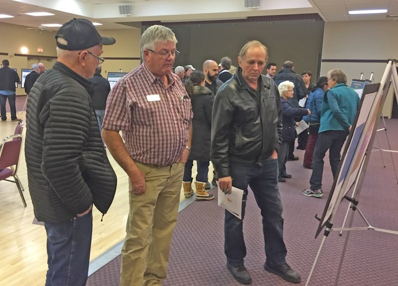
About 60 area residents attended an open house at the Carstairs Community Centre on Nov. 28 to provide input into a proposed new area structure plan.
Development of the Economic Growth Node South Carstairs Plan is being overseen by a six-member steering committee comprised of county councillors and members of the public.
Committee chairman Robin Fair told the meeting that public input will be used to help formulate the plan, which will provide a land use planning framework to guide future subdivision and development within the plan area.
"Probably the biggest thing we want to get out of the meeting from you people tonight is an idea of what you think should happen," said Fair. "We really need your input.
"The idea is to have an area to put all the business and commercial type enterprises, rather than have them scattered in various places in the county.
"That's why it (plan area) is on the south end (of the county) in proximity to Calgary. It's got Highway 2 and 2A, and if we can concentrate all business and commercial in that area, then the net result is going to be maintaining more agricultural land everywhere else."
The plan area is located immediately south of Carstairs, bordered on the north by Twp. Rd. 300, west of Rge. Rd. 10, north of Twp. Rd. 292, and east of Rge. Rd. 14.
The committee is looking for input on the kinds of development that might be suitable in the area and how many subdivisions per quarter section should be allowed.
Proposed business park land use policies in the plan include the following:
ï Internal subdivision roads shall be paved and provided at the developer's expense and shall meet county road and infrastructure standards.
ï Piped communal or municipal water and sewer may not be required if county and provincial standards are met.
ï All infrastructure costs are the responsibility of the developer.
ï Development requiring multiple phases shall prepare a concept plan in conjunction with the redesignation application.
Proposed residential land use policies in the plan include the following:
ï The "first parcel out" of a previously un-subdivided quarter section shall be supported by the county for the creation of one additional parcel.
ï The maximum number of titles for subdivision should be two titles for a quarter section.
ï Residential subdivisions may be considered if redesignation as a farmstead separation meets certain criteria, including that the farmstead has been in existence for a minimum of 10 years or more at the time of application, and if the remainder of the quarter section is maintained for agricultural operations.
Proposed agricultural land use policies include the following:
ï Agricultural land uses will continue to be promoted in the plan area. All lands shall remain zoned agriculture until redesignation for its intended use.
ï Those adjacent to agricultural operations shall respect existing operations. New agricultural uses shall also respect adjacent land uses.
ï Agriculture will continue to be the primary use within the county, while allowing opportunities for new businesses to develop along the Highway 2 and Highway 2A corridor.
ï In accordance with the municipal development plan, agricultural subdivisions shall be a minimum of 40 acres in size.
An eight-page survey was handed out during the Nov. 28 open house.
Respondents were asked to provide comments on the plan's proposed vision statement, which reads: "To provide a focused area for intensive commercial and business park development along established highway and rail corridors while protecting the natural environmental features and allowing for preservation of agricultural land throughout the remainder of the county."
Respondents were also asked to rate proposed goals for the plan, rating from very important to very unimportant.
Those goals include the following: encourage diversification and business retention; concentration of commercial/business park development; preservation of natural environmental features; creation of guidelines for passive recreational space; fostering collaboration with adjacent municipalities; provision of a framework for utility servicing; development of a long-term infrastructure strategy; county-wide agricultural preservation by providing space for future economic development.
Respondents were also asked to identify the types of developments they would and would not support in the plan area.
Those types include the following: agri-tourism; bed and breakfast operation, campground; cannabis production facility; golf course; group home; industrial storage/warehousing; recreational resort; riding arena; small food/drugstore; wind energy systems; offices; hotel; greenhouse/plant nursery/tree farm.
Respondents were also asked whether they agree with the proposal to allow for residential farmstead separation as an option, with first parcel out only (maximum two land titles per quarter section).
Respondents were also asked to comment on the plan's proposed boundaries.
Residents can fill in the survey until Dec. 13.
The survey results will be compiled by staff and considered by the steering committee at an upcoming meeting.
Once the draft area structure plan is completed, following the survey responses review, another open house will be held.


