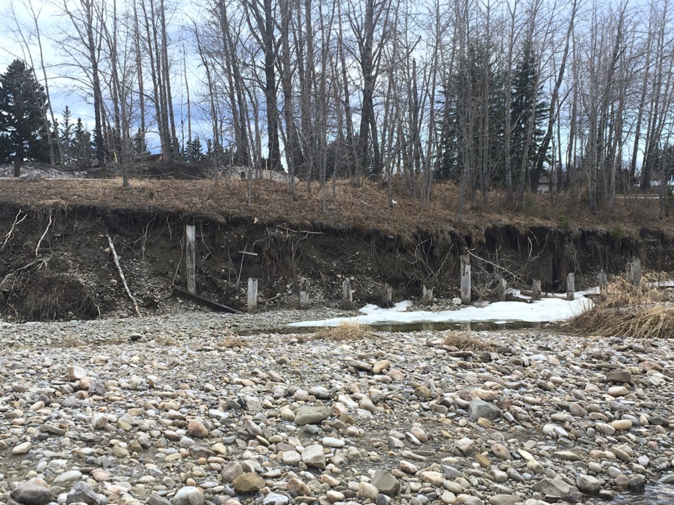
SUNDRE – The municipality’s operations department is keeping an eye on the southern bank of Bearberry Creek just west of the Centre Street bridge after erosion exposed a gas line.
As per provincial regulations, that meant the municipality had to either repair the line and get it covered to a depth that meets code, or alter the line by reconnecting it elsewhere, said Jim Hall, operations manager.
The gas pipeline that was exposed had originally been built in either the late 1960s or early 1970s, he said, adding the utility provided a crossing for the north side of town.
Over time, the creek’s flow – which every spring tends to pick up momentum to drastically varying degrees depending on the season’s conditions such as accumulated snowpack and spring precipitation – slowly but surely eroded away the gravel and sediment that the line had initially been buried under. So, instead of attempting to repair and rebury the line in the same place, the decision was made to abandon the crossing entirely, he said.
“We altered that pipeline so it was no longer at threat of being exposed,” he said.
The work essentially involved cutting the pipe and running a new loop into an existing gas line at another crossing west of the Bearberry Creek pedestrian bridge that’s well protected, he said.
While the gas line has successfully and safely been relocated, the portion of the creek’s southern bank that remains under nature’s sustained assault is not even a stone’s throw away from the three-metre asphalt recreational path.
“There’s some operational concerns, but we are monitoring it,” said Hall, adding flows are being measured and tracked to get a better understanding of the rate of erosion.
Last year, the flow of water reached about 50 cubic meters second; to contextualize that, he said the flow during the 2005 flood was approximately 250 cubic meters per second.
The operations department will have a clearer understanding in terms of potential timelines to develop mitigation strategies once it’s had more of an opportunity to measure this year’s flows. An exponential increase in the rate of erosion would prompt a level of urgency to move faster, but it was still far too early in the season when Hall spoke with the Albertan on April 26 to have a clearer picture of the situation.
In a worst-case scenario wherein the asphalt path eventually collapses into the creek, the municipality would replace the trail by setting it back a distance away, he said.
But when it comes to bank erosion work, he reiterated the municipality’s regulatory responsibility to work in tandem with Alberta Transportation on developing a coordinated response.
Residents might also have noticed a series of posts embedded in the ground along that section of the creek’s bank. Those dilapidated structural remains are not from any past erosion-mitigation projects, but rather footings of a former bridge that used to span the creek, he said
“It was a temporary bridge when they were putting a bridge at Centre Street," he said.


