SUNDRE – The municipal council recently gave first reading to a proposed area structure plan for a parcel of undeveloped land near the town’s northwest boundary.
Benazir Thaha Valencia, the municipality’s manager of planning and economic development, presented the item to council during the regular March 27 meeting.
“There are still a few concerns that need to be addressed,” Valencia told council without further elaborating.
“However, by granting first reading, it allows the application to be circulated to external agencies for comments,” she said, adding the applicant will then subsequently have the opportunity to address any necessary amendments to the proposed Mountain Springs Area Structure Plan.
“At this time, we will withhold scheduling a public hearing date,” she said.
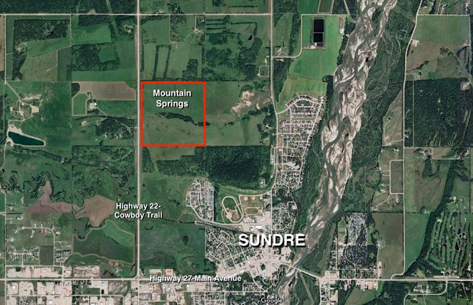
Coun. Connie Anderson sought clarification on the land’s location, and was informed the parcel is located immediately east of Highway 22, or the Cowboy Trail, in Sundre’s northwest quadrant.
With regards to an impending public hearing date, mayor Richard Warnock sought to confirm there is not a strict legal timeline in which to do that.
“That’s correct,” said Valencia.
Council proceeded to give first reading to a bylaw to adopt the Mountain Springs Area Structure Plan.
The land for the proposed area structure plan was once owned by the Hagen family of Sundre dating all the way back to 1906, according to introductory background information outlined in the plan’s documentation.
Since then exchanging hands several times, the parcel eventually came under the ownership of Otto Huhn, a physician, who “was struck by the natural beauty of the land and the remarkable view from the heights overlooking Sundre,” reads a portion of the plan.
Historically used for forage and livestock grazing, the land under this proposal would become subdivided and developed as an integrated residential community.
“The intent of the plan is to reflect in general terms the municipal development vision and sustainability targets as outlined in the Sundre Municipal Development Plan,” the document reads in part.
“Site specific parameters will be detailed at the subdivision plan stage.”
The proposal also outlines plans to include plenty of green space and walking path connectivity along with “a full range of housing options within a medium density housing precinct. It will appeal to those with a variety of income levels.”
Additionally, the plan includes a phased-in approach that would see the Mountain Springs community developed over time as market demands are identified.


